La Nina May Be on Its Way: Implications for Winter Weather Forecasts
La Niña may be on the horizon, impacting winter weather patterns. Here’s what you need to know about its potential effects.
The U.S. National Oceanic and Atmospheric Administration's Climate Prediction Center reports a 60 percent likelihood of a weak La Nina developing this autumn, potentially lasting until March.
La Nina is part of a natural climate cycle that can induce extreme weather worldwide, with varying effects depending on the region. While the exact impact of this upcoming La Nina is uncertain, experts have identified some general trends. They predict that northern parts of South America may experience above-average rainfall, while southern regions of the U.S. and parts of Mexico could face drier than normal conditions. Conversely, the northern tier of the U.S. and southern Canada are expected to be wetter than average.
La Nina represents the cooler phase of the El Nino-Southern Oscillation, a natural global climate pattern characterized by changes in wind and ocean temperatures in the Pacific, which can lead to extreme weather phenomena worldwide.
In contrast, during El Nino, trade winds that usually blow toward Asia weaken, allowing warm ocean waters to accumulate along the western coast of South America. During La Nina, however, trade winds intensify, causing cold water from the ocean depths to rise, leading to below-average ocean temperatures in the eastern Pacific.
These cooler ocean temperatures along with atmospheric changes influence the position of the jet stream—a fast-moving air current flowing from west to east—by shifting it northward. This position can affect storm paths and enhance precipitation by drawing moisture from the ocean.
Recently, Earth experienced a "triple-dip" La Nina from 2020 to 2023. "We had three back to back winters where we had La Nina conditions, which was unusual because the only other case of that happening was back in 1973 to 1976," remarked Michelle L'Heurex, a climate scientist at NOAA. She noted that La Nina events tend to last longer and recur more frequently than El Nino conditions.
"It's unusual although it's not unprecedented," stated Ben Cook, a climate scientist at the NASA Goddard Institute for Space Studies affiliated with Columbia University, in reference to the possibility of a La Nina this year.
Cook highlighted that the frequency of La Nina events can pose challenges for regions recently affected by drought, such as East Africa. "If we're moving into another La Nina event, it means kind of a continuation of those really bad conditions."
L'Heurex explained that the weather effects of La Nina differ by location and season. In parts of South America, eastern Argentina may experience drier conditions, while Colombia, Venezuela, and northern Brazil are likely to be wetter than usual.
"It depends exactly where you are. Part of that is because there's a monsoon cycle, wet and dry season, that goes through Central America and South America, so La Nina is basically modifying the intensity and placement of those monsoon cycles," she added.
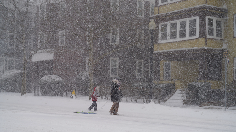
In the U.S., the Northeast and Ohio Valley often experience wetter than typical conditions due to an active storm track linked to the jet stream's position, according to Samantha Borisoff, a climate scientist at NOAA's Northeast Regional Climate Center at Cornell University. The jet stream's waviness can also lead to more frequent cold outbreaks, particularly affecting the central and southern U.S. Although snowfall predictions are challenging and dependent on storm paths, Borisoff noted that New England, New York, and the Great Lakes region generally see increased snowfall during La Nina winters, though this is not guaranteed. Meanwhile, the southern and southeastern regions of the U.S. tend to be drier and warmer than normal.
As for the connection between climate change and La Nina and El Nino, scientists acknowledge that the relationship is still not completely understood. Paul Roundy, a climate scientist at the University of Albany, remarked that climate models often suggest a rise in El Nino frequency and a decline in La Nina occurrences, though not all models align. These models also find it difficult to distinguish between natural variations in these phases and the influence of climate change on ocean and atmospheric warming.
"I would not infer from that that climate change isn't actually causing more El Nino emergence," Roundy explained. "It's just that nature itself has such strong swings on its own. So we can get multiple La Nina events, and maybe in 40 or 50 years we'll be seeing the opposite."
Ian Smith for TROIB News
La Nina is part of a natural climate cycle that can induce extreme weather worldwide, with varying effects depending on the region. While the exact impact of this upcoming La Nina is uncertain, experts have identified some general trends. They predict that northern parts of South America may experience above-average rainfall, while southern regions of the U.S. and parts of Mexico could face drier than normal conditions. Conversely, the northern tier of the U.S. and southern Canada are expected to be wetter than average.
La Nina represents the cooler phase of the El Nino-Southern Oscillation, a natural global climate pattern characterized by changes in wind and ocean temperatures in the Pacific, which can lead to extreme weather phenomena worldwide.
In contrast, during El Nino, trade winds that usually blow toward Asia weaken, allowing warm ocean waters to accumulate along the western coast of South America. During La Nina, however, trade winds intensify, causing cold water from the ocean depths to rise, leading to below-average ocean temperatures in the eastern Pacific.
These cooler ocean temperatures along with atmospheric changes influence the position of the jet stream—a fast-moving air current flowing from west to east—by shifting it northward. This position can affect storm paths and enhance precipitation by drawing moisture from the ocean.
Recently, Earth experienced a "triple-dip" La Nina from 2020 to 2023. "We had three back to back winters where we had La Nina conditions, which was unusual because the only other case of that happening was back in 1973 to 1976," remarked Michelle L'Heurex, a climate scientist at NOAA. She noted that La Nina events tend to last longer and recur more frequently than El Nino conditions.
"It's unusual although it's not unprecedented," stated Ben Cook, a climate scientist at the NASA Goddard Institute for Space Studies affiliated with Columbia University, in reference to the possibility of a La Nina this year.
Cook highlighted that the frequency of La Nina events can pose challenges for regions recently affected by drought, such as East Africa. "If we're moving into another La Nina event, it means kind of a continuation of those really bad conditions."
L'Heurex explained that the weather effects of La Nina differ by location and season. In parts of South America, eastern Argentina may experience drier conditions, while Colombia, Venezuela, and northern Brazil are likely to be wetter than usual.
"It depends exactly where you are. Part of that is because there's a monsoon cycle, wet and dry season, that goes through Central America and South America, so La Nina is basically modifying the intensity and placement of those monsoon cycles," she added.
In the U.S., the Northeast and Ohio Valley often experience wetter than typical conditions due to an active storm track linked to the jet stream's position, according to Samantha Borisoff, a climate scientist at NOAA's Northeast Regional Climate Center at Cornell University. The jet stream's waviness can also lead to more frequent cold outbreaks, particularly affecting the central and southern U.S. Although snowfall predictions are challenging and dependent on storm paths, Borisoff noted that New England, New York, and the Great Lakes region generally see increased snowfall during La Nina winters, though this is not guaranteed. Meanwhile, the southern and southeastern regions of the U.S. tend to be drier and warmer than normal.
As for the connection between climate change and La Nina and El Nino, scientists acknowledge that the relationship is still not completely understood. Paul Roundy, a climate scientist at the University of Albany, remarked that climate models often suggest a rise in El Nino frequency and a decline in La Nina occurrences, though not all models align. These models also find it difficult to distinguish between natural variations in these phases and the influence of climate change on ocean and atmospheric warming.
"I would not infer from that that climate change isn't actually causing more El Nino emergence," Roundy explained. "It's just that nature itself has such strong swings on its own. So we can get multiple La Nina events, and maybe in 40 or 50 years we'll be seeing the opposite."
Ian Smith for TROIB News
Find more stories on the environment and climate change on TROIB/Planet Health