Hurricane Milton Hits Florida's Coastline
Hurricane Milton struck the Gulf Coast of Florida near Siesta Key on Wednesday, hitting as a Category 3 storm.
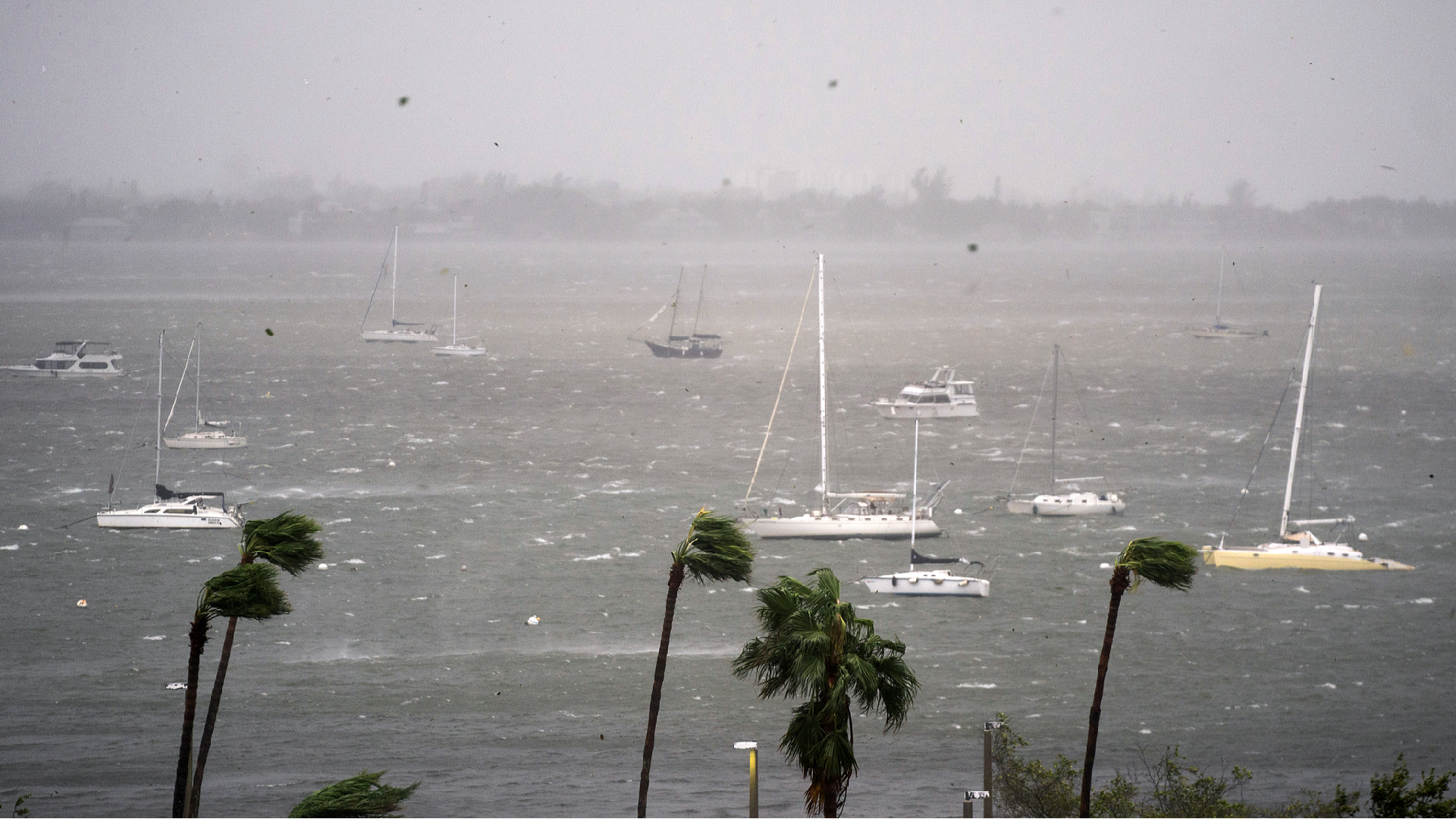
Hurricane Milton made landfall on Wednesday near Siesta Key along Florida's Gulf Coast as a Category 3 storm, bringing powerful winds, a dangerous storm surge, and the potential for flooding to large parts of the state, as reported by the U.S. National Hurricane Center.
Fueled by extremely warm waters in the Gulf of Mexico, Milton achieved Category 5 status twice during its development.
Siesta Key, a barrier island situated off Sarasota, boasts white-sand beaches and is home to around 5,500 residents. Located approximately 113 kilometers south of Tampa, the area did not experience a direct impact from the hurricane, although Hurricane Milton still generated significant deadly storm surge and strong winds nearby.
At the moment Milton made landfall, nearly 700,000 customers in Florida were reported to be without power, according to data from PowerOutage.us. The storm's hazardous surge affected much of Florida's Gulf Coast, impacting densely populated regions including Tampa, St. Petersburg, Sarasota, and Fort Myers.
The intensity and unique trajectory of Hurricane Milton have raised concerns among experts. The storm's rapid evolution was fueled by warm waters, allowing Milton to escalate from a minimal hurricane to a formidable Category 5 within a span of less than 10 hours. Although it weakened, it quickly regained strength, with winds reaching around 290 kilometers per hour, corresponding to some of the lowest barometric pressure measurements recorded in the Gulf of Mexico for this time of year.
Milton's behavior is notable; its path through the Gulf is so rare that the last similar storm occurred in 1848. "The track is not unprecedented but it's quite rare," explained Brian McNoldy, a hurricane researcher from the University of Miami. "And of those that did that track, this is by far the most intense."
Gabriel Vecchi, a climate scientist and hurricane expert at Princeton University, remarked, "It is unusual in a number of ways. This storm is probably going to be very unlike any storm anyone has experienced on the west coast of Florida."
Scientists attribute much of Milton's ferocity to the warm waters present at its development and the effects of human-induced climate change. Warm water is essential for hurricanes to thrive, with surface temperatures needing to be at least 26 degrees Celsius, and deeper warm water enhancing the storm’s potential.
The waters from which Milton emerged, as well as those along its path, hovered around 30.5 degrees Celsius—almost 1 degree Celsius above average and near record highs, as noted by McNoldy. "Part of the reason it was so warm is because of global warming," Vecchi stated, adding that last year's El Niño—an atmospheric phenomenon that leads to global weather changes—and other natural factors also contributed. "Now the storm has a lot more energy to draw on."
Furthermore, the storm's east-northeast trajectory is unusual. Unlike most storms in the Gulf, which typically move from east to west or north, Milton’s direction is influenced by a weather system over Canada and the U.S. East Coast. This system is shifting the typical westerly winds down to Milton's location, where autumnal winds from the west are not common. "It's extraordinarily bad," McNoldy observed.
Sanya Singh for TROIB News
Find more stories on the environment and climate change on TROIB/Planet Health