Study reveals that river erosion contributes to the recent rise of Mount Qomolangma
A recent study reveals that river erosion is accelerating the uplift of Mount Qomolangma. Researchers have found that the processes of erosion play a significant role in shaping the mountain’s growth.
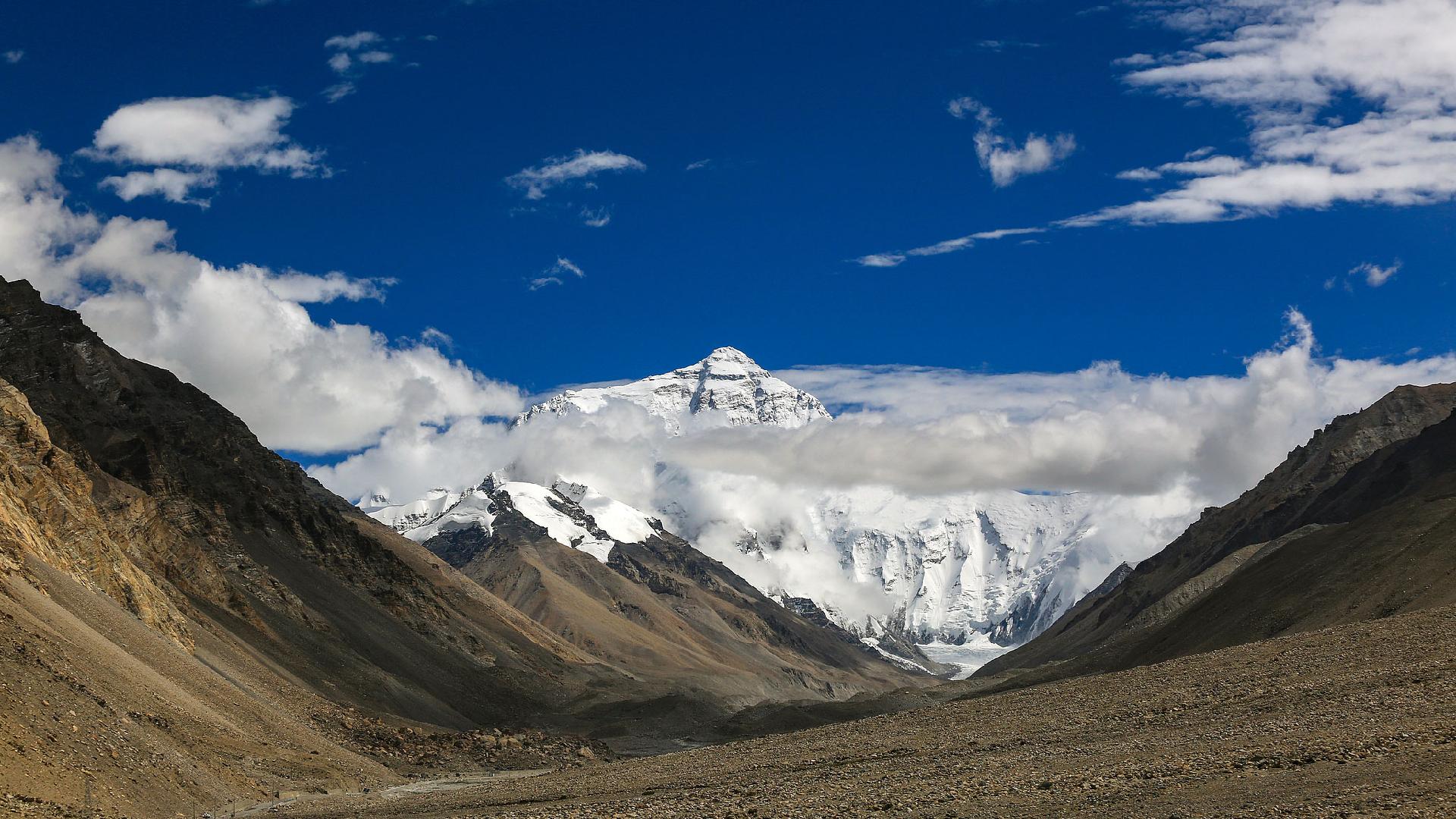
Why is Mount Qomolangma significantly taller than other major peaks? A recent study provides evidence that river erosion is responsible for the mountain's recent uplift.
The research team, led by Wang Chengshan from the China University of Geosciences in Beijing along with colleagues from University College London in Britain, published their findings in the journal Nature Geoscience on Monday.
As Wang, an academician of the Chinese Academy of Sciences, explained, the formation of Mount Qomolangma and the entire Himalayas primarily results from the collision between the Indian Plate and the Eurasian Plate.
However, the collision theory alone does not adequately account for the height difference between Mount Qomolangma and Mount Qogir, the second highest peak, which is only tens of meters taller than the third and fourth highest peaks. This disparity hints that a unique mechanism might be responsible for the uplift of Mount Qomolangma.
Through years of investigation, the scientists identified a unique evolution of the water system surrounding Mount Qomolangma, particularly related to the Kosi River, an ancient waterway.
The study asserted that approximately 89,000 years ago, the Kosi River underwent a river capture event— a frequent occurrence in mountain-building areas. This process involves one river eroding and taking the flow from another, leading to significant growth in the drainage area and an increase in the erosion rate, with maximum annual erosion reaching 12 millimeters.
As the riverbed deepened, the surrounding rocks experienced isostatic rebound due to the reduction in weight, further contributing to Mount Qomolangma's uplift.
The research projected that since the river capture event, Mount Qomolangma's elevation has been rising by about 0.2 to 0.5 millimeters per year, accumulating an additional height of 15 to 50 meters.
"Although tectonic movements remain the primary cause of the uplift of Mt. Qomolangma, this study reveals a new mechanism of mountain uplift caused by river capture, which helps people better understand the evolution of orogenic belt and the process of peak formation," said Wang.
Mathilde Moreau contributed to this report for TROIB News
Discover more Science and Technology news updates in TROIB Sci-Tech