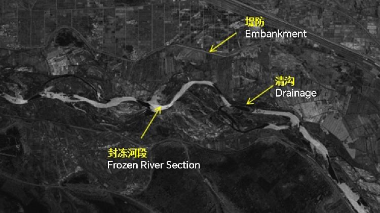
China's inaugural water management satellite transmits its first image
China's inaugural water conservancy satellite has successfully transmitted its first image. This marks a significant milestone in the country's efforts to enhance water resource management through advanced satellite technology. The satellite aims to monitor and analyze water-related issues, contributing valuable data for agricultural planning and environmental protection. This achievement highlights China's commitment to utilizing space technology for sustainable development and effective water conservation strategies.

Shuili-1 was launched alongside three other synthetic aperture radar satellites from the Taiyuan Satellite Launch Center in Shanxi Province on December 17. Together with four previously launched satellites, these new SAR satellites will establish a constellation that aims to deliver continuous high-resolution radar imagery for a variety of water-related tasks. They are anticipated to be officially operational ahead of the flood season next year.
The satellite is intended to provide critical monitoring data for severe weather events, including floods and waterlogging disasters, as well as ensure the safety of rivers, lakes, reservoirs, and water conservation projects nationwide. Chen Deqing, director of the Satellite Remote Sensing Application Center at the Ministry of Water Resources Information Center, elaborated, "Most importantly, the satellite's monitoring capabilities can penetrate through clouds and rain, making it effective even in harsh weather conditions like storms and rain."
Moreover, these satellites come with advanced intelligent processing features that enable onboard data processing and facilitate efficient result transmission.
Chen also noted that the constellation is structured to integrate data from multiple sources, which will be processed to produce a range of specialized products tailored for the water conservancy sector.
Mathilde Moreau contributed to this report for TROIB News
Discover more Science and Technology news updates in TROIB Sci-Tech


