Heavy Rain and Snowfall Drench Northern California
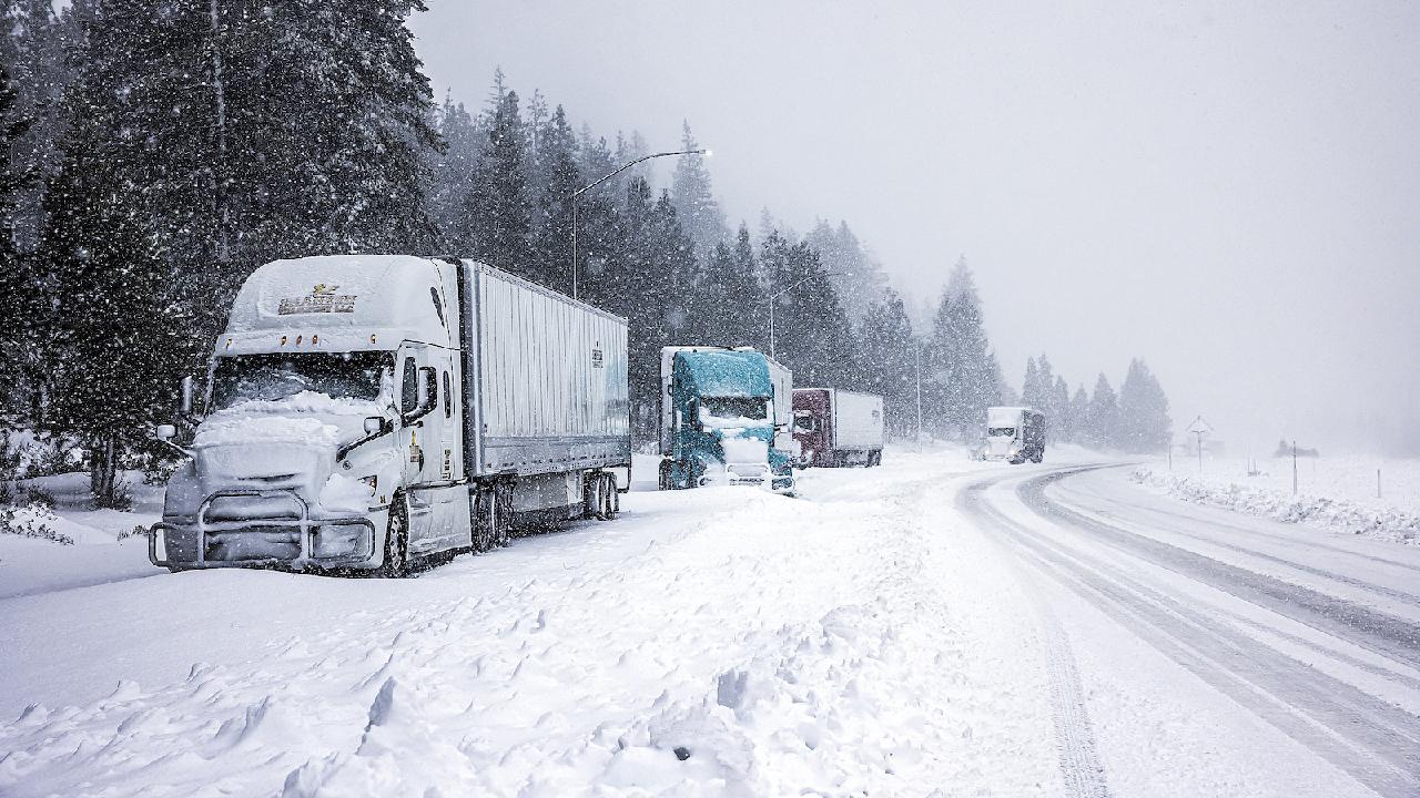
A powerful storm has brought substantial rainfall and heavy snowfall to Northern California, resulting in significant weather impacts across the region.

The storm had initially struck the Pacific Northwest earlier in the week, resulting in two fatalities and widespread power outages affecting hundreds of thousands, primarily in Seattle. As the storm moved into Northern California, various roads were closed due to flooding, with strong winds causing trees to fall.
Forecasters issued warnings regarding the dangers of flash flooding and rockslides in regions north of San Francisco, attributing these risks to this season's most potent atmospheric river—a long plume of moisture originating over the ocean and traveling through the sky.
On the East Coast, a separate storm delivered much-needed rain to New York and New Jersey, where rare wildfires had been active in recent weeks. This rainfall helped mitigate fire risks for the remainder of the year and benefited ski resorts gearing up for the upcoming season. Meanwhile, blizzard warnings were in effect across parts of West Virginia through Saturday morning, with forecasts predicting up to 60 centimeters of snow and strong winds that could complicate travel.
In Humboldt County, California, the sheriff's office transitioned evacuation orders to warnings for residents near the Eel River after forecasts indicated only moderate flooding. Officials advised residents to remain prepared for ongoing storm effects throughout the week.
Flooding also led to the closure of scenic Highway 1, also known as the Pacific Coast Highway, in Mendocino County, near the Garcia River, with no timeline for when it might reopen, according to the California Department of Transportation.
A minor mudslide posed a threat to a home in Fitch Mountain, near Healdsburg, situated in the hills by the Russian River in Sonoma County. Officials expressed concern as moderate rain persisted and the slide had the potential to expand, impacting several homes located downhill.
In Washington state, over 138,000 residents continued to face power outages, primarily in King County. Crews were busy clearing streets of fallen lines, branches, and debris. Utility officials warned that the outages, which began on Tuesday, might extend into Saturday.
Residents flocked to a senior center in Issaquah for warm meals and to charge their electronic devices.
Gale warnings were issued along the coasts of Washington, Oregon, and California, with high wind warnings in effect for several areas of Northern California and Oregon. Additionally, winter storm warnings were in place for portions of the California Cascades and Sierra Nevada.
The National Weather Service in Reno, Nevada, reported a wind gust of 200 kph at the top of Palisades Tahoe ski resort, located about 16 kilometers northwest of Lake Tahoe, where some ski runs were operational. Mount Rose recorded gusts of up to 140 kph, leading to its closure due to adverse weather conditions.
The storm arrived on the West Coast on Tuesday as a "bomb cyclone," characterized by rapid intensification. It unleashed powerful winds that downed trees onto roads, vehicles, and homes.
Authorities cautioned about the risks of flash flooding, rockslides, and debris flows, particularly in areas where recent wildfires had destabilized hillsides.
In the Northeast, which had been experiencing drought conditions, more than five centimeters of rain was anticipated by Saturday morning north of New York City, with snow expected at higher elevations.
Northeastern Pennsylvania, including the Pocono Mountains, received significant snowfall, leading to numerous school closures. Higher regions reported accumulations of up to 43 cm, while valley areas like Scranton and Wilkes-Barre saw lesser amounts. Over 100,000 customers across ten counties faced power outages, prompting the state transportation department to implement speed restrictions on certain highways.
Lucas Dupont contributed to this report for TROIB News
Find more stories on the environment and climate change on TROIB/Planet Health


