Maui satellite photo shows full scale of deadliest US fire in more than a century
The Landsat 8 satellite captured the deadly flames that burned through the town of Lahaina in Hawaii and killed at least 99 people.
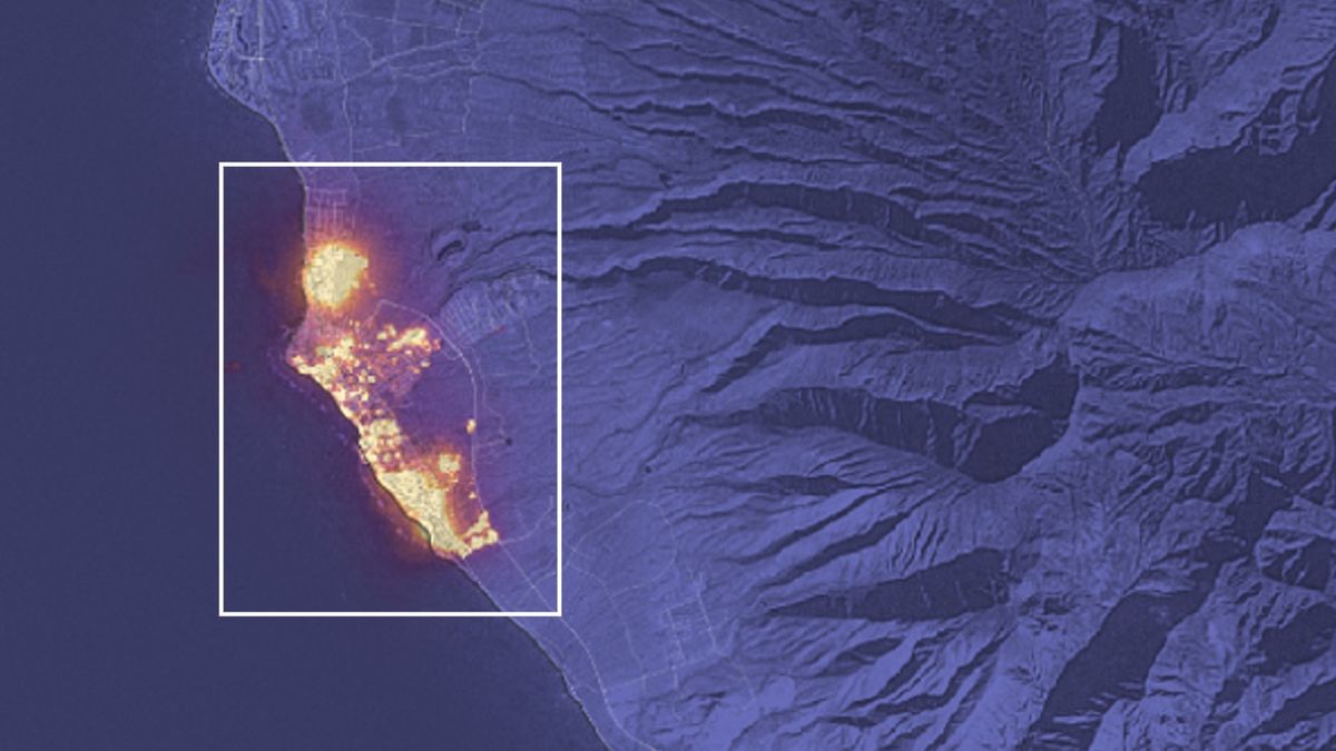
The Landsat 8 satellite captured the deadly flames that burned through the town of Lahaina in Hawaii and killed at least 99 people.
Discover more Science and Technology news updates in TROIB Sci-Tech